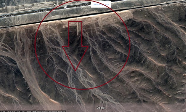
The mountainous roads near the kilo 135 area towards Wadi Al-Hitan Reserve - File photo
CAIRO – 24 October 2017: A Hard battle was fought by the Egyptian forces against militants on Friday, October 20 on Giza-Al Wahat Road. Seventeen security personnel were killed and fifteen others were injured.
According to a statement issued by the Interior Ministry, the police forces are still deployed around the area. The desert road was closed from both directions of Giza and Fayoum with a number of checkpoints to besiege any fleeing terrorists.
The attack that took place near the kilo 135 area also led to the murder of 15 militants according to the Interior Ministry.
Here are the detailed locations of the attack:
 The location where the Egyptian forces started to head to Giza-Al Wahat Road
 The exact distance between the beginning of Al Wahat Road and the kilo 135 area where the clashes took place
 The distance between the kilo 135 area and Wadi Al-Hitan Reserve (Whale Valley)
 Magnified photo for the mountain area around Wadi Al-Hitan Reserve
 The mountainous roads near the kilo 135 area towards Wadi Al-Hitan Reserve
Comments
Leave a Comment